Thank you for your interest in the Public Lands Program!
Let's get you onboard!
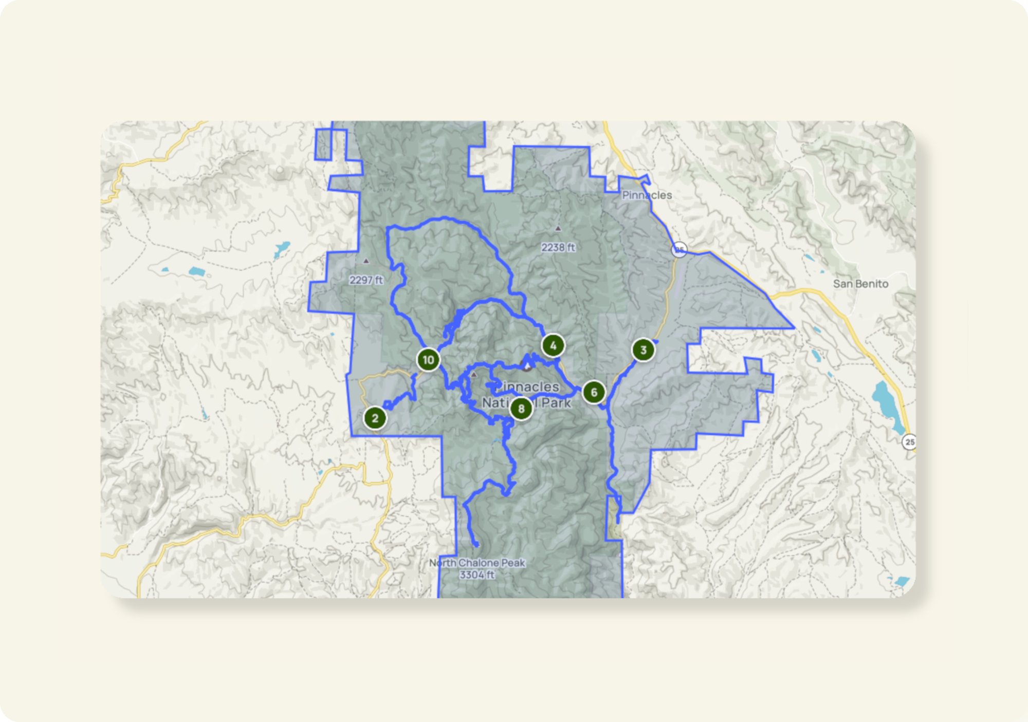
To get started, please review the information about how we need to receive trail boundaries from you to grant you permission to the correct trails. Do not skip this step, as it provides important information on completing the onboarding form below.
The data you submit allows us to assign digital permissions to the trail pages on AllTrails within the areas you manage or help support. The permissions given to you will be for existing trails on AllTrails and/or geographic areas you manage.
Don't know what trails from your area are on AllTrails? Learn how to find trails near you here!
If you need to addnew trails, you can do so after we complete your initial onboarding. If you have any questions, feel free to email your account manager at publiclands@alltrails.com.
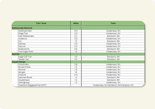
In the below form you will have the opportunity to submit your digital polygon boundary data in one of three ways:
Geospatial polygon boundaries
Online directory
List of trails
1. Geospatial polygon boundaries
A shapefile folder (including the .shp, .dbf, .shx, and .prj files) or geodatabase of the polygon boundaries you manage works best.
.png?width=251&height=70&name=NCC%20logo%20(1).png)